MergeTABs
This utility allows you to merge up to four MapInfo TAB or MIF files into
a single TAB or MIF file. This is useful with MapInfo's free ProViewer since
it does not allow more than one TAB file to be displayed at once.
MergeTABs allows a different colour to be assigned to each merged layer. This can
be useful to distinguish between, for example, contours, drainage, and roads - see example below.
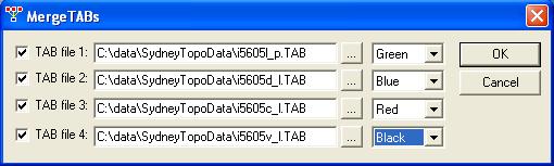
MergeTABs merging free topo files from Geoscience Australia.
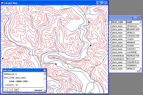
Example of the output of MergeTABs displayed in MapInfo ProViewer.
Download: MergeTABs.zip (194 K)